Recall our rough and tumble Spring weather just a few months back that resulted in significant tree damage and loss in the Almond Orchard. Excessive wind gusts took down many trees as witnessed at ground zero. A Google Maps Satellite image update (3/31/2017) depicts the losses from an aerial perspective. The first image, using Google Earth’s Time Machine feature, shows both West and East fields and dates from March of 2015
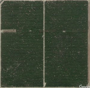
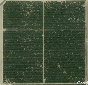
The lower image is the more recent
Knowing the number of tree rows and tree spacing we calculate a maximum possible number of trees at 16,995. Of course there will always be gaps because of inefficiencies. In 2015 we estimated 16,337. As 171 of those underlie the PG&E high tension wires and have been severely topped. We can figure 16,166 Healthy, mature, producing trees in 2015.
One could use the Google Maps Mapmaker feature to drop a pin at the newly visible missing tree map locations to get a count. That is tedious work. Instead we will rely on the Almond Harvest Machine to give us a value. It employs a digital counter that increments each time it moves from one tree to the next. Harvest begins next month and we will compare last year’s with this year’s.