Category Archives: jogging

Cache La Poudre

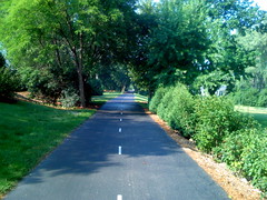
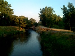
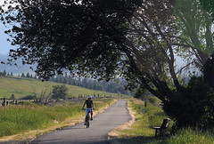
The River Trail — Poudre River Ranch section: features the Greeley Canal #3, a large hay meadow, cottonwood groves and a stretch along the sandstone ledge between the top of the river bluff and the river itself. Miles of concrete path shared by friendly local folks on bikes and the occasional stray cow. [ g-map pedometer ]

Glacier Park Intl

10 minutes into this run and buildings and road noise are distant. Not that Kalispell is a metropolis; a western outfitters store is browseable and the antique shop too. A grain elevator raises tall just past that. Locate the Great Northern Railway of NW Montana – Rails to Trails Historical Route which cruises open pasture land views. Montana is fine summer country. [ g-map pedometer ] A separate run through Lawrence Park briefly stays with and then crosses the inviting Stillwater River as it parallels Kalispell’s Whitefish Stage Rd. suburbia on paved greenway. Local knowledge informs that Californians have discovered its reasonable value. [ g-map pedometer ]

roadkill

Oh snap! After 244 miles the pedometer dongle piece which rides the shoe slipped out of its little sock never to be seen again. I thought it would be a needle-in-a-hay-stack, so it was a surprise to spot it on the street. Closure. Alas it was inop. Crushed by vehicle.

Stone Mtn

An easy run with sidewalk on Robert E Lee Blvd; keep the granite dome off the corner of your eye to stay on course. There is a car park fee but this helps to keeps the cruisers and traffic count down. The perimeter is 4.8 miles of concrete or pavement with some shade at times from tall standing trees however I made this jog after sunset (due to famous Atlanta traffic and… well that’s another story, read: don’t leave the hotel with quick directions from the staff, sans map, GPS, or cell backup). Georgia’s Stone Mountain Park offers a striking view and if you have the inclination hike the walk up trail from Confederate Camp to the top of the landmark (1.3 miles).

watergate

The Chesapeake and Ohio Towpath Trail was a terrific run. With a raining drizzle the weekend multitude stood clear. I spotted two deer, a heron… There were geese with adolescent gosling. Usually these creatures take flight or bravely stand ready to do so. A parent took offense as I slogged passed and tried to take a piece from my shoe like a tyre-biter dog would challenge a passing car. There was a nice little kick from the adrenal gland as I high stepped away awe-stricken. Guess he showed me who was trail boss. The view from the canal embankment is wonderful with glimpses of the Potomac River, stone wall terrace and big woods. A point of interest on my 3 mile route section is the Boathouse at Fletcher’s Cove: a canoe launch point for the Potomac. This soft trail is crushed rock and hard pack sand. A paved bicycle path shadows until the railroad trestle then diverts to Bethesda, MD (CCT). Danged goose.

the nations summer capital

Had not heard of Delaware’s Rehoboth before my arrival yesterday and small world to be reading an article about it in the USA Today, today. The quaint old town of Lewes is nearby and less tourist arcade. Got the chance to jog the beach with a return loop through high end residential, Silver Lake. The route is broad sandy beach or boardwalk as you like, and inland, wide boulevards with bike lanes each side.

CMH

Downtown to Ohio State University. At the apex of Confluence Park cross the street and join the bike trail northbound. The din of traffic abates slightly once you cross the river at 3rd Street. This is the Olentangy Trail. Wide asphalt and generally level. [ Gmaps Pedometer ] 3 miles.

CMH

The WARNING-Sewage Overflow sign post didn’t deter the urban vagrant who chose to dip his fishhook anyhow. The Upper Scioto Trail shadows the Confluence of the Olentangy and Scioto Rivers and industrial decay. The section that I ran offers a view of the downtown high rise skyline from paved greenway. The Olentangy Trail is on the ToDo list for next visit.