Ghostly Old Cowtown is a nice cool down stroll on the Arkansas River Bike Trail. My 4 mile loop, like the dusty town, had few users (weekday). The trail is asphalt / concrete and flat running.
Category Archives: jogging
Horace Williams Tract
These 900 acres are laced with soft trail through woods. I should have pre-run this loop on the Bolin Creek Trail. My trail buddy looked at me askance as we struggled with navigation. There are many (mountain bike) side track diversions and I was less than a masterful guide. The TrailHeads offer hand drawn maps of lost wanderings, but a GPS handheld sure would have offered assurance as our aborted track resembled thus. Great area for exploration. There’s even a preservation petition.
Chappaquiddick
The Chappy Beach (private) club is the vistor’s first landmark. There are many expensive estates, none of which are viewable from the road by common folk. This low on the tourist radar – country loop is a quiet jog / bike ride, as the island accessible by water taxi can only convey cars 3 per trip. The Litchfield Rd section is washboard packed sand (too soft for a street bike). 5 miles.
Cape Cod
There are cross road choices which necessitate a route map as the Province Lands bike trail meanders sand dunes. Despite the lands end location these mountainous drifts obscure the seascape. Paved 5 mile loop with no soft shoulders.
Left Bank
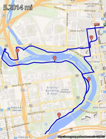
View Map of the downtown Convention Center and Arena District to Dodge Park and Confluence Park. The multi-purpose trail is asphalt and concrete. The city skyline is aways in sight with several historic buildings and parks along side the Scioto and Olentangy Rivers. [ gmaps pedometer ]
South Carlsbad State Beach
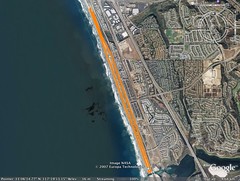
Beach Access at Lifeguard Station 29 is by steep bluff trail eroded by local surfers. The sandy portion between cliff and surf can be narrow at high tide and it is strewn with smooth water worn pebbles. There are few beach goers mostly from a camping park above. For a change of scene I made the return run topside via bike lane on the Blvd.
[ gmap pedometer ]
Philadelphia FlarePath
My initial read was peripheral airport support, taxi stands, arterial freeways, and remote parking but I stepped from my hotel island on an airport perimeter trek and found recreation anyhow. Fort Mifflin and Hog Island Roads border active runways and reed shrouded water front. Traffic is light and wide soft shoulders offer relief. I ducked through these rushes for a view of tanker ships, and on the distant shore of the Delaware River, BP Oil and the Mobil Refinery in New Jersey.
Little Rock
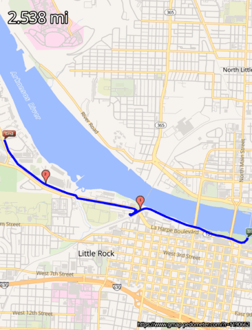
Saving the North Little Rock side of the Arkansas River for next visit because the pedestrian bridge at Riverfront Park was under renovation. Ran the Medical Mile and a section of street to just shy of Rebsamen Park before turning back. Rivertrail.org is predicting a complete loop someday. Too far for these legs.
SLP
San Luis Potosi` is off the beaten path; not the usual tourist stop over. Most of the visitors are managers and executives from GM, Toyota inspecting their component parts manufacturing. Ventured out of the Westin hotel “compound” and into upscale residential just a jog away.
Green Bay
The Fox River Trail is a fine greenway system. Alarming though that they collect a usage fee ?! for bikes or blades. Could start a trend… Find the trailhead at Adams and Porlier Streets and cruise asphalt surface or softer shoulder. [ g-maps pedometer ]