Springtime hit while looking for an outing and because it was there, I ran this airport circuit. The southern perimeter is actually the Geneva Spur, part of the country’s first and oldest rail-to-trail project known as the Illinois Prairie Path. Easy, flat, soft or grass shoulder and light traffic (Sunday).
Category Archives: jogging
Hilton Head

The island offers a wide expansive beach boulevard avenue which is flat and hard packed. It was very suitable for jogging. Would recommend that when planning a bike route; note the wind direction. Take shelter inland by looping the beach portion as the downwind leg. ( captured this shot with the 10 sec timer and by using the beach surface for lack of a tripod)
Highbanks
Arrive by car if possible because of traffic congestion, noise and fumes on State Rte 23. Once inside the park though it’s solitude and refuge. Splendid natural hardwood forests are on view from all sides. There are some ups and downs and an occasional switchback but the trail is wide hard pack crushed rock. Quite a few people take exercise here in the Highbanks Metro Park. I sampled the Dripping Rock Trail which is a marked loop.
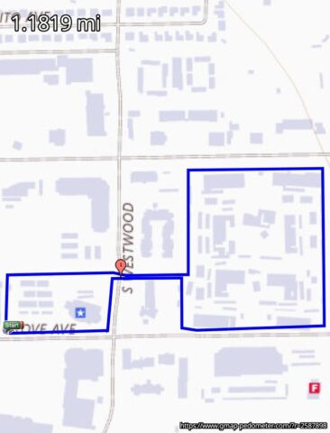
Island in Mesa

Boxed in by Malls and asphalt I was pleased to find this old alfalfa field to turn perimeter laps. It’s gone to weeds and the developers are closing in on what may be the last of the old Dobson Ranch.
26.2 with Donna The National Marathon to Fight Breast Cancer
The 26.2 with Donna Dede Marathon was streamed LIVE on a webcast so it was thrilling to watch and listen as my sweetheart began a 1/2 Marathon on Jacksonville Beach.
 Also thrilling that I could track her progress as the athletes were wearing RFID chipped ankle bracelets. When the race was started they ran across an RFID wire stretched over the road. The wire powers the device with a high frequency signal picked up at the antenna which transponds its unique serial number. Everyone’s time is tracked by running past the wire. At strategic choke points they passed a different wire which marked time. Using T and D formulae one can derive ET, Pace, and ETA statistics. I’m streaming tears and cheers of joy for her!
… data at the 7 mile marker
![]()
OBX Marathon 2008

Did the 1/2 with #4108 and had a grand time. The Wx gods provided a light quartering tailwind and mild temperatures and plenty of sunshine for the early A.M. start. The course route ran a closed lane of the main highway with occasional forays into the scenic outlying neighborhoods. What an experience! Event organization was terrific and to the cheering spectator folk: thanks for coming out.
race ready
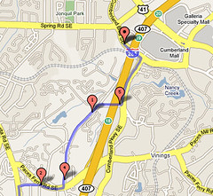
Testing the asphalt jungle outside my Smyrna, GA hotel I ran the Cumberland Connector. Extra wide bone pounding concrete sidewalk links to the Silver Comet Trail system. The Silver Comet would be a fun bike ride journey as it extends 61 miles clear to Anniston, AL. The connector is marked with painted lines but direction becomes unclear at traffic intersections due to lack of signage. The connector sometimes flips from one side of the street to the other and without a birds eye view one has to guess which crosswalk to take. Plenty of vehicular noise until reaching the Silver Comet trunk.
Little Rock

Could have enjoyed a rinse off / cool down after this summer day Little Rock run. Escaped suburbia to find an undocumented there and back trail along Rock Creek. The trailhead is obscure behind a strip mall dry-cleaners. The unspoiled area is watershed and part of the Fourche Initiative. (I wasn’t pronouncing it right either) It is wide crushed rock path through woods.
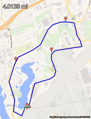
Manchester, NH
Stuck at an airport perimeter road hotel and not seeing anything exciting on the satellite map or encouraging from the Google Street View, I stepped outside anyway. The loop that I ran, thankfully, offered protection from the traffic with consistent asphalt sidewalk and granite curbstone. I did spy an isolated abandoned railway bed at an apex on Goffs Fall Rd. in which an adjacent foot path appeared to trail in the direction of downtown Manchester. Next time.
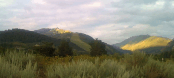
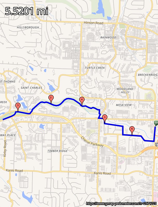
Aspen Thin Air

Crossing the Roaring Fork River before sunrise on the Stein Trail is a beautiful thing. This section joins the Rio Grande Trail, named from the railroad that used to follow the river. Despite the mountainous surroundings the trail grade never exceeds 3%. Looping back through residential completes the circuit on the Pitkin County Open Spaces and Trail system. My route began across the highway from the Aspen airport on ABC road in the Business Park. Even in August the early morning air has a chill and a pair of gloves would have been useful. The trail surface is hard packed crushed rock and sand. The multi-purpose greenway is concrete. 5.5 miles.
