Category Archives: adventure

Kayaking the Cottage Creek

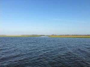
Breezes light and sunshine giving way to mostly cloudy provided good conditions on this Fall morning. Launch into the salt marsh was from the newly constructed ramp in Southport. Our small group explored the Cottage Creek as far as we could go. Twisting marine marsh narrowed to single file and then the gentle turns became switchbacks. Finally the Smooth Cordgrass and Needle Rush closed in and in the narrows the paddle was no longer useful as designed but did serve to swish at these tall reeds that were impeding progress. Using the paddle as pole to push against the mud bottom shallow at this point we slogged through.

spotted: Periwinkle, a nickel sized sea snail also birds: Egrets and a Cormorant or two

We came. we saw, and so reversed course picking our way back out; trying not to lose our way. After awhile each turn starts to blur but fortunately there were few getting lost in the maze options and we could DR toward the sea. Coming out onto the ICW we hugged the shore until boat traffic permitted a direct crossing to the other bank.

We elected to circumnavigate the spoils island directly across from the marinas there on the ICW by way of Dutchman Creek and the Elizabeth River. The relatively open water was freedom compared to the close confines of the creek. The exposure to wind, waves, and powerboat wakes was stimulating.

Kayaking the Lockwood Folly River

At 12 miles roundtrip this was a personal best for endurance. This gray Fall morning day was rather bleak compared to the previous weekend. Temperature 60F and NNW wind at 12 gusting 20 mph at times presented an uphill battle. Lost my Tilley hat (recovered) to one of these with no one else to the wiser.

Lockwood Folly River is a few miles from its ICW connection to the Atlantic Ocean so there are tidal flows to consider. Luckily I was positioned for success with high water and slack current on the outbound leg.

The closest forecast is – Holden Beach, NC

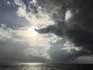
Against the wind the outbound leg to the NC 211 Bridge took 2:15 but the return (1:35) was a joy with current beginning to move in my direction, the wind at my back, and the Sun making an appearance.

Launching into Fall Weather

Kayaking The Black River – Newbys Landing

The Black River meanders and oxbows as it makes its way to the Cape Fear. Mature cypress swamp forests flank the river banks. The water surface reflects black (hence its name) from brown tea stained tannins.

Researchers deem some of the old trees to be 1000+ years old but it is difficult to take core samples as most are hollow (like this one pictured). We had hopes on this outing to view Methuselah and the other two sisters but perhaps next year. Cypress are deciduous and as it is now Fall season they have lost their needles. The remaining Spanish Moss draped on bare limbs makes for an eerie feeling of isolation.

Kayaking the Waccamaw River at Longs, SC

Launching from the Chris Anderson Landing we began a pleasant paddle excursion downriver. This section traverses the Waccamaw River Heritage Preserve so it is undeveloped wilderness.

Kayaking the Waccamaw at NC 904

We slipped into a quiet cove to nose around and here I am parked between the Cypress. Prime fall color from these. S’ man and I tried to return to this cove after the weekend but even after such a short time it had become landlocked.

Lots to explore on this river that is 140 miles in length from its North Carolina lake origin to discharge in South Carolina. This river section sampling goes through Pireway Game Land. Antlerless deer season and distant rifle fire sounded reminding us that we were some distance from city life.

Beneteau San Juans

It was a Beneteau Oceanis 381 with a layout similar to last years except below deck was a flip flop opposite. Only one quarter berth which was a full. Larger V berth forward. Diesel forced air heater which we used a couple of times. Chilly until noon. Sunny afternoons. Never rained. The AYC yachts are individually owned and you could tell that our boat was looked after.

Big galley with two refrigerators. Propane BBQ. Galley stove oven had a broiler.

Smaller Lav space (as if that was even possible). The holding tank was a mere 15 !! gallons and with strict eco regs in US waters that meant we really had to watch it. I had the pleasure of pumping it out twice. Well, pump-outs are encouraged by being free anyway.

We anchored out once. Picked up a ball at two other stops. BTW, you taught Spencer well on the fore-deck He was invaluable. Leah was a complete noobe on day one but by mid week she had it down and by voyage end had the sailing bug. Stayed on a linear mooring one night and one night on a dock. Also, we had to put our own boat in its slip back in Anacortes. No such thing as a marina skipper.

Cleared Canadian / US customs which was good experience. Navigation fairly easy with the GPS tracking and land ho. Fewer visual cues on the long sail to and from Victoria in which case it was GPS track and DR

I kept a watchful eye on tides and currents. We traversed a few tidal current rips but those were a non event. We had to be careful for floating logs. We saw several. Man that would have made a big noise to collide. Remind me not to sail there at night. Big container ships in the lanes too. The most current was 2.5 knots which didn’t last long and luckily was going our way.

The most wind that we saw was 16 knots at which full sail was slightly over powered close hauled. The main sail could be furled into the mast. Very trick. 1 to 2 foot wind waves at times. For the most part the wind was 6 to 10 knots. The ride was always good. Our charter had Radar with AIS if we’d have been caught out by fog but we were only concerned once and it turned out not to be a factor.

Like Father like son, Spencer almost did an endo off of the transom but fell into the dinghy instead. Whew!

53 degrees. I was concerned about going overboard while underway and nobody noticing right away. That would have been bad scene.

Voyages of the Talmid

North Carolina / Georgia Loop

[available: full size presentation]

This 475 nm cruise was a mix of coastal offshore and the AICW. Each have challenges. They both offer scenic splendor with a bit of adventuring

Typically, the inside passage is a pleasant ride with smooth water and most would choose it for comfort. It is much slower because of its twists and turns. Due to lack of maneuvering space it can’t reliably be sailed and must be motored. In fact, the ICW is very narrow in most cases and a rigid course line must be strictly followed to avoid getting stuck in the mud (run aground). Further, it is generally unwise to traverse the ICW during darkness for it is difficult to spot hazards to navigation. With a bit of planning there are many option locations for stopping to rest and at days end.  I find the venue a nice change of pace and even though helmsmanship is very high workload it is likely that one will have a genuine restful night at anchor — just be mindful of the mosquitoes.

Coastal offshore is very different and you must have a stomach for it as there is constant motion depending on the sea state.  Aside from the continual action attributable to wave and swell, it can be somewhat relaxing and less stressful, your body does adapt to this environment. Glorious sailing is possible and one is able to minimize the use of noisy auxiliary diesel power. Talmid, with a displacement hull / full keel, is happiest in the deep blue and with shallows and bridge crossings not being a factor. With an adequate watch routine you needn’t make layovers and can track nonstop. If wind permits, follow a rhumbline course and the miles click by. The autopilot steers your course freeing the mind to keep tabs on the big picture and contemplate life.


Hot fun

A July afternoon on anchor was a near experience in heat stress. Keep in mind that A/C is a shore powered luxury only available at the marina; on the water you take what you get. This outdoors lifestyle can be pleasant, even on hot days, if there is a breeze across the water but during this exposure wind was calm.  [Cod Harbor Tangier Island.]
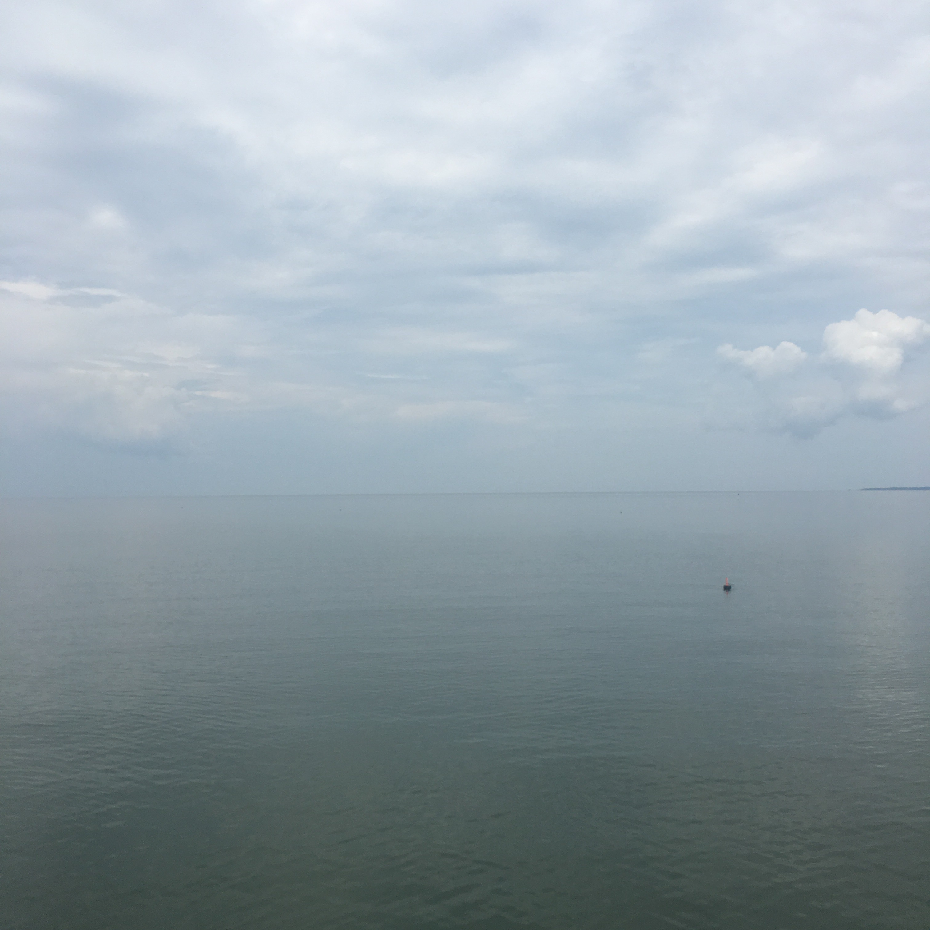
…and from the picture evidence observe the lone crab pot in a sea that is flat glass. The opaque sky seems to merge horizonless into haze and humidity. You can take a dip in the sea but with a water temp of 91 indicated it is not refreshing. The sun is high and shade areas on deck shrink The only escape is inside the cabin below.

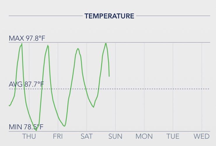
This is the representative cabin temperature log. Strip down and perspire. Try to hydrate. The water from onboard tankage is room temp. Hopefully there are some ice cubes left in the refrigerator box.

This was two days later on the Potomac. Same temperatures but with wind relief. Very nice. Even looks cooler doesn’t it?

Crab Pot

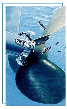
The bane of intracoastal cruisers these seasonal traps are everywhere. They are at times waywardly placed in the middle of navigable routes, which is where we connected with one or should I say connected to us. It was broad daylight (and you can imagine the extra challenge at nighttime) and was unseen but suspect when we heard and sensed a thump. A crap pot consists of sunken coup resting on the seabed, a stout retrieval line is floated to the surface by a marker buoy. Boaters must scan for these little floats but they are easily obscured by wavelets and glare. The float marker, styrofoam and plastic, can be harmlessly nudged aside by the hull but it’s the attached rope that is drawn to your spinning propeller that is the spoiler.

After the unexpected bump scan checked engine RPM and detected no changes in sounds or frequency but did note a loss in speed of about 1 knot. Aside from the thump this was the only clue. The only way to know for certain was to inspect the prop.

The prop is about 2′ below the surface and the only way to view is to stop and go over the side with mask and flippers; an unscheduled swim.

Most of these pesky hazards are in coves and harbors, anchorages are littered although in fairness they are distributed in linear string fashion every x number of feet. When you are anchoring they can be intimidating and always a challenge to stay clear to avoid mixing. If you happen to tangle, your prop is likely to be jammed into a non-functioning balled up mess. A saw tooth hand knife is necessary to laboriously cut the cord away. An enterprising idea is to install a set of propshaft blades that act to preemptively slice and dice.
I’m not convinced that this would actually work effectively at slow maneuvering RPMs in an anchorage or when using reverse.

During my impromptu inspection I discovered we had indeed been fouled and had been dragging an entire bundle of float, line, and trap for a mile. Our prop-wash had slammed the float through the propeller aperture snagging on the rudder without the line wrapping up in the prop. Phew! Lucky easy removal for us — but not for the Waterman. He will be wondering where his Crab Pot and Catch are…

Local Knowledge

There was an obscure note on the chart that we overlooked. It needs bells and whistles because it caused some chagrin. Transiting local shoreline routes are challenging due to shallower water and obstructions. Our Washington DC back to NC trip just completed was roughly 450 miles of mostly Atlantic Intracoastal Waterway (ICW) so I guess we were fortunate that we escaped [most of] the unseen. The ICW is supposed to be maintained to a nominal depth of at least 12′ at low tide. Talmid requires 6′.  Satellite view of the Masonboro Sound on the New River – Cape Fear River
…and the NOAA chart presentation  – same locale

The dashed lines indicate the charted bounds of the ICW. Here is a closeup of the chart and observe the notice that we found pertinent which reads Shl to 5 ft 2016.

Translated: Shoal to 5 feet and dated last year. Ordinarily this would not be a problem area at high tide and I’d been through here twice before but at low water our deep keel found it — and we slid to an abrupt halt.

Worth mentioning is that the inland water is murky dark. Your eye can’t tell if it’s 2′ or 20′. There is a depth transducer onboard which gives us a digital indication of actual depth. We have a aural warning alert set to 10′ to get our attention should depth become a concern. In this instance it did give alert but the depth readout quickly went to 8′ and then just as fast I saw 4.6′ with no time to react. Stuck.

Pure sand bottom, so damage only to my ego. We were able to use reverse propeller at max RPM to extricate and not have to wait for the water to rise. After the fact, and back at my desk, I downloaded this Hydrographic Survey from the Army Corp of Engineers and one can clearly see the issue. The image below is the satellite view with the survey overlay.…and the relevant closeup section (just North of green lateral daymark #135)

Blue is 15+ deep water. Red = bad; and must be avoided. Ordinarily you keep the boat between the channel markers and you should be okay.  From the comfort of my armchair I can see that the preferred and ONLY route through favors the one side.

A published guide book might prove useful as no doubt there have been many gone before that made the goof. I can now say that I have first hand [local] knowledge.