Category Archives: jogging

Anastasia State Park

Valentines Day brought warm sunshine to St. Augustine which inspired a jog on white, wide, flat, firm packed sand. There have been coquina quarries featured here for 300 years but these were obscured by massive ancient dunes populated with Sea Oats and hardy grasses on this beach run. At one point, however, the St. Augustine Light was visible between the mounds. Our spot was delightfully quiet due to an admittance fee required. 6 miles

Total distance: 6.03 mi
Average speed: 8.44 min/mi
Download file: St Augustine Anastasia Beach.gpx

Twin Falls Idaho

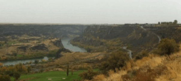
The trick is to find the access to the Snake River Canyon. The view was spectacular from the rim of shear drop cliffs but the floor below beckoned so after a rambling jog on a wet rainy day I discovered a trailhead visitors center (despite the lack of signage) and began a decent. The objective? A spectacular 200′ water fall at the Perrine Coulee Creek terminus. The base of this fall is accessible by a short mud trail off of Canyon Springs Rd. The Perrine Bridge would also be a great walk / jog. Next time…

Total distance: 5.26 mi
Average speed: 9.10 min/mi
Download file: Perrine Coulee Falls.gpx

San Jose Guadalupe River

From the downtown Center for the Performing Arts to the Guadalupe River Park. This paved greenway starts in concrete jungle with freeway flyways for canopy but gradually assumes a natural original country feel toward the park area. There was some crossing on bridges back and forth confusion as the trail route flip from one side to the other before arriving at a trail detour (scheduled completion Fall 2010) due to a railroad realignment. Le skunk (pepe le pew) unabashedly crossed the path, tail raised high in defiant warning salute. As the sun gets low the downtown portion populates with street people, possible predators and idle youths some of them rough and tough looking. Suggest mid day to be safe

Total distance: 2.35 mi
Average speed: 8.28 min/mi
Download file: Guadalupe River Trail downtown.gpx

Bermuda – Coney Island Park

Not much to see here although you can view the Grotto Bay Beach Resort from across Bailey’s Bay. The park is a short distance beyond the Bermuda Rail Trail head so it’s a nice little extender if you have the energy. The adventure is in the main trail previously reviewed.

Total distance: 0.69 mi
Average speed: nan min/mi
Download file: Bermuda - Coney Island park.gpx

Virginia

The Norfolk Waterside is hamstrung by development built to waters edge. As such there isn’t room available for a dedicated point A to point B greenway. There is a disjointed Elizabeth River Trail however, which was worthwhile. Starting at Harbor Park Stadium the route passes waterfront businesses, small park areas with glimpses of Naval shipyards on Hampton Roads. The USS Wisconsin, on permenant display, is a point of interest. There are rewarding views in the Ghent District after crossing busy Brambleton Ave. One can view renovated historic homes of mariner and colonial architecture. This is a fashionable place to live.

Total distance: 4.26 mi
Average speed: 9.19 min/mi
Download file: Norfolk.gpx
Total distance: 2.89 mi
Average speed: nan min/mi
Download file: ORF Norfolk Waterside.gpx

Iowa

The urban renewal planners in Des Moines have made their inner city greeenway a priority. The city has a certain healthful vitality and I witnessed many users on the system. My route began downtown at City Hall and followed the Des Moines River where the Raccoon River forks. The end point was a loop trail around Gray’s Lake Park. These rivers were swollen from recent heavy rains necessitating minor detours for flooded areas.

Total distance: 87.72 mi
Average speed: nan min/mi
Download file: Des Moines.gpx

current state of the art

FAQ: What do you use to keep track of and journal your outdoor exercise?

Use Nike Plus with an iPod Nano for repetitive routes. If you like, the iPhone 3G already has the receiver/software built in. You will still need to acquire a sensor for the shoe. Nike brand shoes are not required if you buy or fabricate a pouch to hold the sensor that typically attaches to shoe laces.

There is an excellent utility on the Gmaps Pedometer website. You can calculate distance by strategising beforehand or mapping your path after the fact — saving the route for future reference. These days high-end smartphones feature Global Positioning which means that an expensive Garmin or Magellan accessory for that function is no longer necessary. With smartphone software to manage GPS one can record a trek in real time. There are quite a few applications of this genre from which to choose. I use this app when I want to map a new trail I’ve not previously explored. This app uses the built-in GPS to track waypoints and even allows for picture snaps along the way. Tap a button and the whole shebang uploads to the cloud thusly.

Highbanks Metro Park

The last time I ran the Dripping Rock Trail the ground was bare and dry. Winter brought record snow this year which made for a picturesque scene. Evidently folks use these trails regardless of season as the path was well packed. Traction at 35 F was fair to poor especially on the steeper inclines. The park is named for the 110 foot bluff that overlooks the Olentangy River. There are more trail settings on this river downstream but the environment is decidedly urban.

Total distance: 2.53 mi
Average speed: 18.50 min/mi
Download file: CMH highbanks_metro_park.gpx

Eagle Spur

This trail was once part of a rail system which ran from Durham to Duncan it is orphaned from the better know ATT and not well traveled. The trailhead sign gave pause and we did see a man walking out with rifle slung. According to this reviewer, the area is managed by NC Wildlife Resources Commission, so I guess guns are okay. Not used to taking exercise with the hunters though.

Total distance: 2.31 mi
Average speed: 8.23 min/mi
Download file: Eagle Spur Trail - Durham County.gpx

Bayside Trail

Taking in the scene at the salt marsh I read about the delicate balance of nature, the sensitive Eco system and how this wetlands was now protected and being reclaimed by plankton, fish and fowl. From the 1920’s the area had been in environmental decline; zoned for industrial and disposal usage. Just behind me was a large hump of a hill . Its sides grown over with brush and shrub. Its flat sloping shaved top green with grass now has a golf driving range park perched upon it. Who would know that until 1987 this innocent looking mountainous lump was the city landfill dump? I was pausing at the Sanchez Lagoon section of the Bayside park. The trail is parallel to its better known parent the Bay Trail which offers a cleaner view of the San Francisco Bay as opposed to the obtrusive Bayshore 101 Freeway on the other side of the mud flat. I’d not traveled it before so it was nice to cover new ground and discover the (former) identity of the area. BTW, I can recommend Gabrielle & Daniel’s (gourmet) Mexican Grill at the Golf Center; not holding its restored location against it.

Total distance: 2.23 mi
Average speed: 8.45 min/mi
Download file: SFO Bayside Trail.gpx