 Playing now, early episodes of a English Go-Go Spy genre: The Avengers. Undecided if these episodes were filmed on a limited budget or more likely; the Brits were waaaaay behind Hollywood. In fact, the DVD re-master(ers) allow a disclaimer/apology for the primitive sound stage and video output. This is an early (1962) series pre Dianna Rigg (Emma Peel) featuring Honor Blackman. The socially incorrect acting dialog give historical insight into a classy era sans action stunts and fight scenes.
All posts by cs
Road hazards
 A flying rock chipped the glass leaving a starburst. The expert with a battery powered resin pump and UV light to cure the catalyst sealed the fissure insuring continued happy motoring on the OEM windshield. Apart from this pure magic repair the amazing thing was that the total elapsed time from Insurance Co. phone call claim to job completion. 2 hours
Waukegan, IL

38F with face stinging ice pellets but otherwise periods of sunshine and wind my Gortex and fleece provided relative comfort as I tackled The Greenbelt Forest Preserve. Smooth running on wide hard pack crushed rock trail loops. There is a claim that this natural habitat of Oak trees and swamp was farmed at one time by decedents of freed slaves. Also that Green Bay Road, which splits the preserve, sits atop the mid-continental divide. There would appear to be some history to the place. Had a stare down encounter with this handsome creature otherwise I had the place to myself. I would imagine that the area is quite picturesque during the green season.
Union Station
 No Smoking in the ticketing lobby today. You can make out the uneven wear from decades of foot traffic; undulations reflect in the polished marble floor of the North Hall waiting area. The Union Station in Kansas City was built as monument to train travel before the age of airlines or the personal automobile. Its usage peaked during WWII and then began a long decay until the building structure was rescued less than 10 years ago. There is some interesting history here which includes Harvey House and a gangland shoot-out. I felt wonderment as I strolled through.
Room with a View
| life on the road; sometimes nice, sometimes not so nice | ||
 3rd floor, Superstition Freeway, Mesa. |
vs. |  34th floor, downtown, Kansas City |
Glamour Days of Flying
DPA
Springtime hit while looking for an outing and because it was there, I ran this airport circuit. The southern perimeter is actually the Geneva Spur, part of the country’s first and oldest rail-to-trail project known as the Illinois Prairie Path. Easy, flat, soft or grass shoulder and light traffic (Sunday).
Hilton Head

The island offers a wide expansive beach boulevard avenue which is flat and hard packed. It was very suitable for jogging. Would recommend that when planning a bike route; note the wind direction. Take shelter inland by looping the beach portion as the downwind leg. ( captured this shot with the 10 sec timer and by using the beach surface for lack of a tripod)
Highbanks
Arrive by car if possible because of traffic congestion, noise and fumes on State Rte 23. Once inside the park though it’s solitude and refuge. Splendid natural hardwood forests are on view from all sides. There are some ups and downs and an occasional switchback but the trail is wide hard pack crushed rock. Quite a few people take exercise here in the Highbanks Metro Park. I sampled the Dripping Rock Trail which is a marked loop.
Oh Yeah, That’ll Buff Right Out
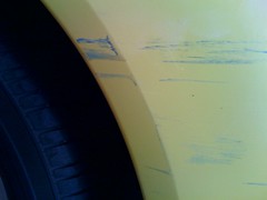
 Some dirty dog in a blue parking lot get-away swapped paint with our yellow one. No witnesses.


