The WARNING-Sewage Overflow sign post didn’t deter the urban vagrant who chose to dip his fishhook anyhow. The Upper Scioto Trail shadows the Confluence of the Olentangy and Scioto Rivers and industrial decay. The section that I ran offers a view of the downtown high rise skyline from paved greenway. The Olentangy Trail is on the ToDo list for next visit.
All posts by cs
FSD
The Big Sioux River Recreation Trail and Greenway is built on 19 miles of dikes used for flood management. I made an abbreviated loop of the wide open airport section. The lane is asphalt becoming dirt in the rural countryside. Note that stiff breeze across prairie farm land can factor against your headway.
Reality Check
I guess I’m spoiled by *** and **** Star hotels but it’s slim pickens here in South Dakota. The choices are Super 8, Sleep On Inn and their ilk. Ours features an indoor water park and tiki bar casino attraction. Shown is an hotel amenity; tie wrapped to the desk with fishing line so you don’t have to open your beverage with the furniture
SDL
Lo-hanging fruit (lemon) on overgrown backyard fences dot the Indian Bend Wash greenbelt. I picked up the route on the Stone Creek Golf Course and went north. Turn back at Thunderbird so as to avoid the low rent neighborhood beyond. Wide concrete or soft shoulders and levees. No shade of any sort. Bring hat.
Closed
The bridge at the Black Creek trailhead is off its mounts. Must have been one helluva storm surge to do that but despite the precarious deck angle, it was stable when I ventured onto it. The Lake Trail, part of Lake Crabtree County Park, is a 6 mile lake front hike through wood and marsh.
Umstead
On a weekend it’s possible to traverse the SAS campus on foot without mixing it up with commuters or private security guards. The eastern exit of the office park is rural country side and after crossing the old bridge into Umstead the path becomes hard packed sand in natural woods. Umstead has many hiking trails and diversions but I was intent on finishing the loop. 5.2 miles
Texas Squall
Cutting it close. The wind blew dry dust at first. Tornado sirens alerted and we witnessed horizontal sheets of rain and hail arrive. Pea sized hail pelted a Ramper on his tractor tug and a brand new Lear in tow which hustled for dry hangar safety. They didn’t make it. New ice the size of Reese’s Peanut Butter Cups must smart, because the driver bailed and ran for cover sacrificing the idling rig to whatever Mother Nature would serve up. The two pilots, high and dry but fearing damage to the hull for their jobs, could do nothing but bolt out into the wind & wet, unprotected. Misguided legs did not know whether to zig zag back for body protection or take command of the tug. In a frantic confused display of concern, they ran about arms thrust upward cursing Ramper and wailing to the Gods.
iron stomach
Waiting to see if I turn green – – or not. I’m usually first in the breakfast line. The eggs and biscuits tend to dry overdone if you arrive for a helping after an hour or two or more of simmering. This morning I’m downing my scrambled eggs which are still wet and just the way I like them. They have an exotic flavor of charcoal broil. Ummmm. Unusual, but then again, I’m in Texas so maybe this is how the locals change things up. Having finished and while weighing the second course I hear another patron in the place making noise about the eggs being bad and something about having gone off… The head waiter takes a sample from buffet, makes a face, and within ear shot agrees with the suspicion. I see him take the offending batch back to the kitchen. I sit there pondering my now empty plate.
HOU
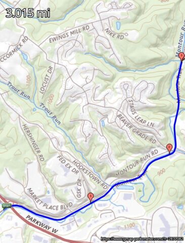
One lap around the airport perimeter. Local advice sez stay clear of the rough residential area that surrounds so keep the route in the public open. Near the control tower is the original art deco municipal terminal, now a museum. Sidewalk, asphalt and grass and plenty of fresh aire. Sure beats the confines of the hotel fitness room. [ gmaps-pedometer ] 6 miles.
COS
The Pikes Peak Greenway section of the Colorado Front Range Trail is a mile high so keep in mind that each lung full will not count as much. The path parallels the brisk flowing Fountain Creek with a picturesque Rocky Mountain vista nearby to the west. The route beginning at the southern end runs 14 miles to the Air Force Academy. It is hard packed dirt and sand. Trail heads are scarce. I had to jump a low fence next to private property in order to access.