I wanted to present 10 Years of jogging stats recorded with Runmeter an exercise logger. I used this app to display stats, in a way to offer incentive to self improve or at least to encourage workouts. Retired from the daily grind it is time to showcase it. I wanted to post all of my history in one large map overview.
Data Ethics: Your data should be YOUR data –empathizing the importance of data ownership and control, particularly in the context of personal information. Runmeter allows for the export your data and other apps may allow or should act similarly.
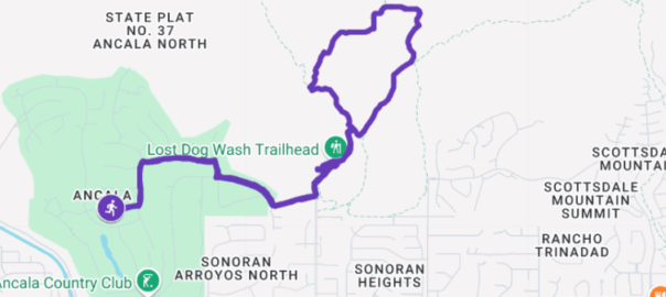
Before starting a run I would dutifully activate my tracker. Various parameters would be saved as data points from which a statistical summary was derived. Included in the collection was a GPS trace route. I blogged the more memorable jog locations when away from home base with the idea to revisit them or allow anyone else who might be keen in doing so.
Each map has a subset of waypoint data plots (1,000+) that make up the track. Google Maps is obliging and allows users to import their map data without the complication of an API. However there are limits to this free functionality. A [Google] My Map is limited to one GPX file import per layer. A My Map has but 10 layers for a single map creation. Well, I have over 700 events. They will not all of them fit. Granted that some of these maps are repeats. I suppose I could weed those out. That would reduce the burden some but too tedious.
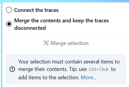
The solution was to combine ALL of the GPX files into one using an online file editor: gpx.studio Their merge utility would merge the contents while keeping the traces disconnected. The output was one very large (66 MB) file. But Google choked on it because of another My Map limitation a 5 MB size hard limit on an imported file. Curses.
Plan B. Sticking with gpx.studio, which is thankfully robust and displaying all of my individual files, I decided to export combined route maps in sections instead of all together. A gpx.studio utility Clean GPS points and points of interest with a rectangle selection tool.
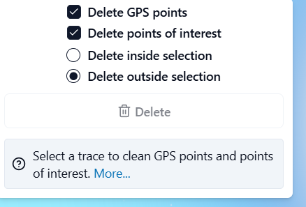
Drawing a marquee around a map area that I considered to be of manageable size, I was able to export the grouping into a new gpx file. This file of 5MB or less could be accommodated by the My Map layer.
All groups imported to individual map layers completed, witness the end product embedded here: