with geo linked pictures
Category Archives: hiking
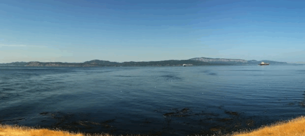
Stuart Island
North of San Juan Island is Reid Harbor on Stuart Island where we anchored and set came ashore in the dinghy. A day trip hike of the island was picturesque.
A good day trip out and back with many photo opportunities. Part of the San Juan chain you will need a private boat or light plane or take a water taxi from Roche Harbor.
BVI Road Town
from tourist town to local residential and some sheep — some photos and stats here
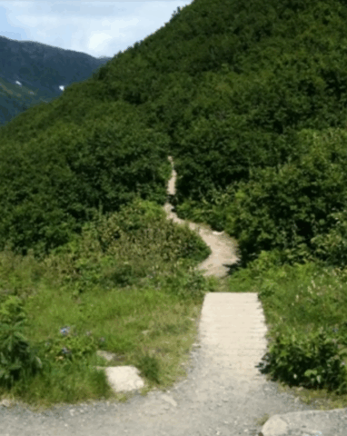
Bent Creek
 | With only a recommendation in Ashville, I ventured in expecting a walking hike but found that I was able to jog at least a third of it. There is a level crushed rock road from the Hardluck Trail Head all the way to the NC Arboretum with numerous branch trails best explored with map. This section of the Pisgah National Forrest is popular with the mountain bikers due to its close proximity to Asheville, NC. but there is plenty of width. Arrive early before automobile parking becomes saturated. |
Jost Van Dyke Hike
pictures posted here an stats
Jost Van Dyke Loop
Consulting a satellite map my route looked rather flat and benign but in reality it wasn’t a jog. Not even a walk; it was a huff and puff steep incline hike. Surfaced and maintained road ended abruptly although still passible with a sport ute in low gear under dry conditions. I had the hillsides to myself. Just me and the wild goats. I was surprised to encounter them as were they and they took off like deer.
Calaway Peak
Grandfather Mountain State Park near Boone, NC and the Blue Ridge Parkway Scout Trail hiking
Huffaker Hills
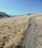
I had some concern for reptiles, or rather — my bare skin legs as I traversed a narrow trail with dry summer range grass and rocks to either side (the next peak over is named Rattlesnake Mountain) A mountain bike might have provided more clearance and a sense of isolation. However, the only creature that I could spy on this hike was an occasional fast over the rocks lizard. Granville W. Huffaker, an early pioneer and homesteader in the Reno area in whose name this natural open space is preserved, likely furnished this dry grazing feed land for cattle. The beef supplied Miners at the Comstock Lode back in the day. The stone embedded unmarked trails have gentle rises with sweeping views allowing for confident navigation.
An Alpine Loop
Stanley Park
 I believe that the graphic designers/writers for the PC game MYST received inspiration from this place. The seawall greenway has wonderful views. The interior is laced with trails shaded with Redwoods. Stanley Park has a distinct island feel with Coal Harbour, Burrard Inlet, and English Bay on the perimeter. This is a great close-in escape from downtown Vancouver, BC.