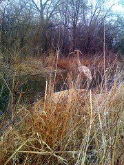
 Sunday morning grey mid February had the Chisholm Nature Trail to myself ‘cept for this rusty water fowl on the creek — must of stayed too long.
All posts by cs
home movies
Dad Harrison was an early adopter. Action photography for the hobbyist did not become mainstream until years following. This clip is part of an archive that was originally captured on 8 mm filmstrip. At some point these films were copy | transferred to VHS cassette tape. This media is now obsolete as well. Using an analog to digital converter his films can be passed on to the next generation, preserving his effort. A music track has been dubbed with artistic license but if you wish to sample the original goods you can mute the audio. In those days the viewers at home in the living room would supply laughter and narration (if they weren’t already asleep).
The automobile (at 1:45) appears to be a postwar Oldsmobile Torpedo 2 door sedan circa 1946.
Refreshment
 Adventured a taste sip from the hotel lobby urn containing sliced cucumbers and unknown greens. Swamp back water? No, tasted like one would imagine a cucumber flavored drink. The other choice, next to, was a more conventional citrus. Sliced orange, lime, and lemon. That one, however, tasted like a bad mixed cocktail. Needed a cucumber chaser after that sample.
Good Morning Preflight
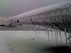 A little Type I required Had to take off my mittens to snap this pic of our iceberg jet. Burrr.
lunch spot
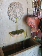 |
at a fine Indian buffet restaurant but unsure about the fluid contents of their fountain… |
Street Cafe
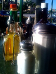 |
Still Life on Le Jeune Rd |
Stanislaus and M

Circa 1961: Hillman – Sunbeam. Leach must have been required to take these brands to get the rights to sell Jaguar. Out of view on the NW corner was the new car showroom for Slavich Bros. During this era they began selling Mercedes-Benz through benefit of their Studebaker – Packard franchise. Several years later Toyota was added as Studebaker faded but the facility was just too small and the Toyota deal was sold. This left Mercedes-Benz and Jeep — an unusual combo… The diagonal corner shown in the left of the picture was the Slavich Bros., used car lot. Ralph and Frank Slavich sold Willys after the war. Here is today’s street view for comparison.


You also will do better here!
Difficult to imagine but in the bygone days of 1971 this was an authorized Mercedes-Benz showroom. This small facility, glassed with plate window at the time, displayed 2 new cars. There was a single desk shared by two salesmen. The old building (originally The Larson Hotel) had a sidewalk curb driveway leading through to a back interior space which housed a 5 bay Mercedes-Benz service department. Adjacent (far right white façade with window awnings pictured) stood their Mercedes-Benz parts department.
Opposite (across street) was a main office showroom featuring Buick, Pontiac, GMC, Opel, Jeep (CJ-5), Hondacar (the N600, early Honda predecessor) , Subaru (GL) and the building can be seen in an 1988 historic picture (below).

The dealership franchise was originally operated by one Claude L Allred
Circa 1968 entire conglomerate was owned by legendary car dealer Arnold Wiebe. Wiebe acquired an additional facility for authorized sales of British makes such as the Austin (America), Jensen (Healy and Interceptor), Lotus (Europa).
Radio media (spot ads) would boom Mr. Wiebe’s Dutch dialect in a 20 second advertisement touting special pricing and encouraging the listener to drive to the corner of Main & Bridge in Visalia where “You Also Will Do Better Here!” and punctuated with “HAVE a Good Day!” signature tag lines.
ANTONOV Design Bureau
 Greetings Comrades!
streaming on the road
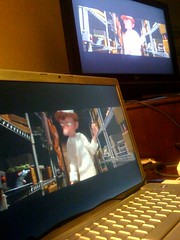 hotel WiFi
Netflix Instant View
laptop w/ S Video dongle
audio out cable
LG HD TV
Ratatouille