A July afternoon on anchor was a near experience in heat stress. Keep in mind that A/C is a shore powered luxury only available at the marina; on the water you take what you get. This outdoors lifestyle can be pleasant, even on hot days, if there is a breeze across the water but during this exposure wind was calm. [Cod Harbor Tangier Island.]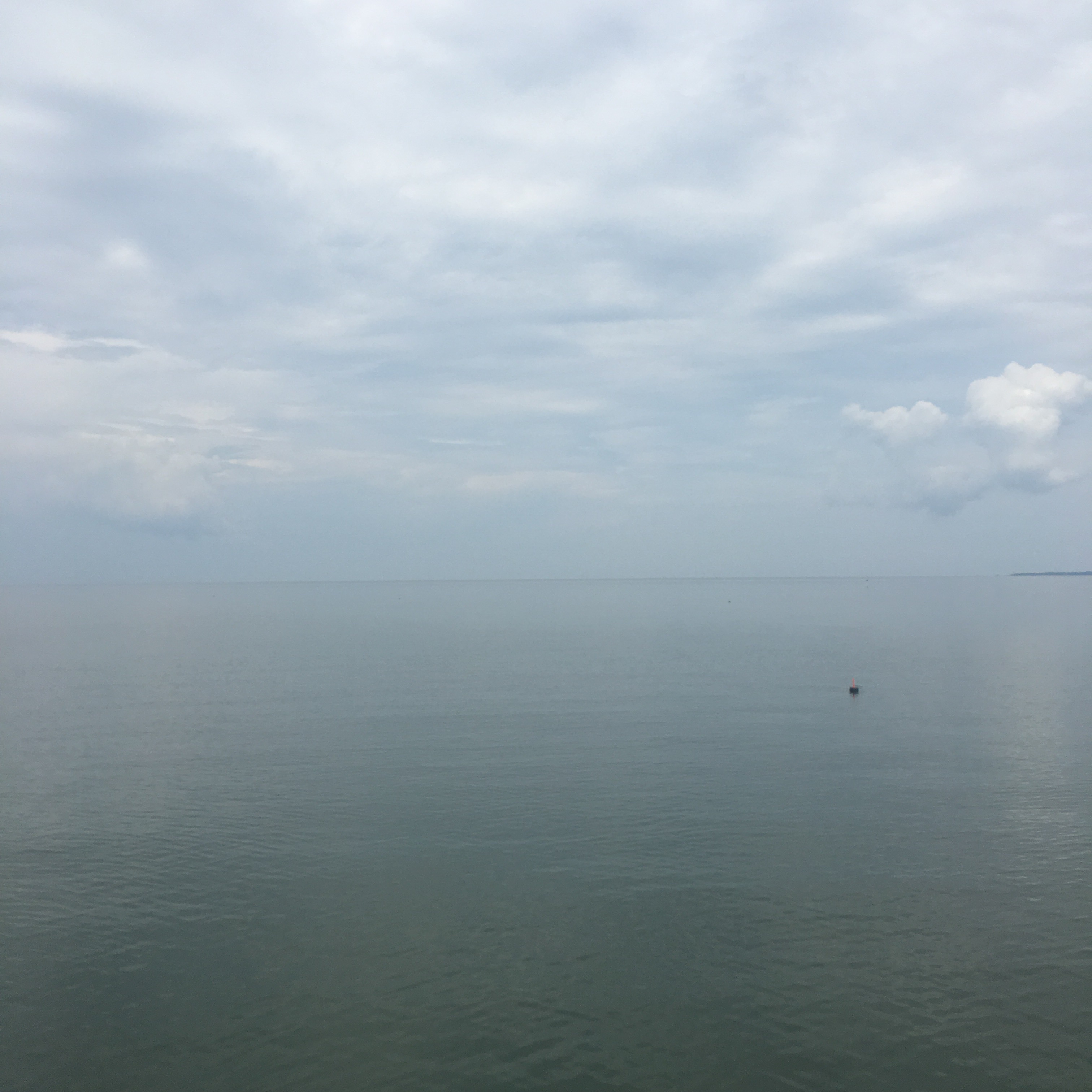
…and from the picture evidence observe the lone crab pot in a sea that is flat glass. The opaque sky seems to merge horizonless into haze and humidity. You can take a dip in the sea but with a water temp of 91 indicated it is not refreshing. The sun is high and shade areas on deck shrink The only escape is inside the cabin below.
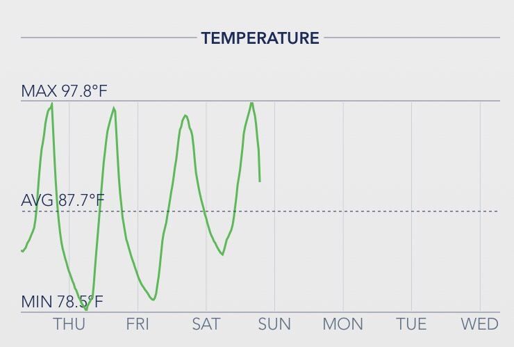
This is the representative cabin temperature log. Strip down and perspire. Try to hydrate. The water from onboard tankage is room temp. Hopefully there are some ice cubes left in the refrigerator box.
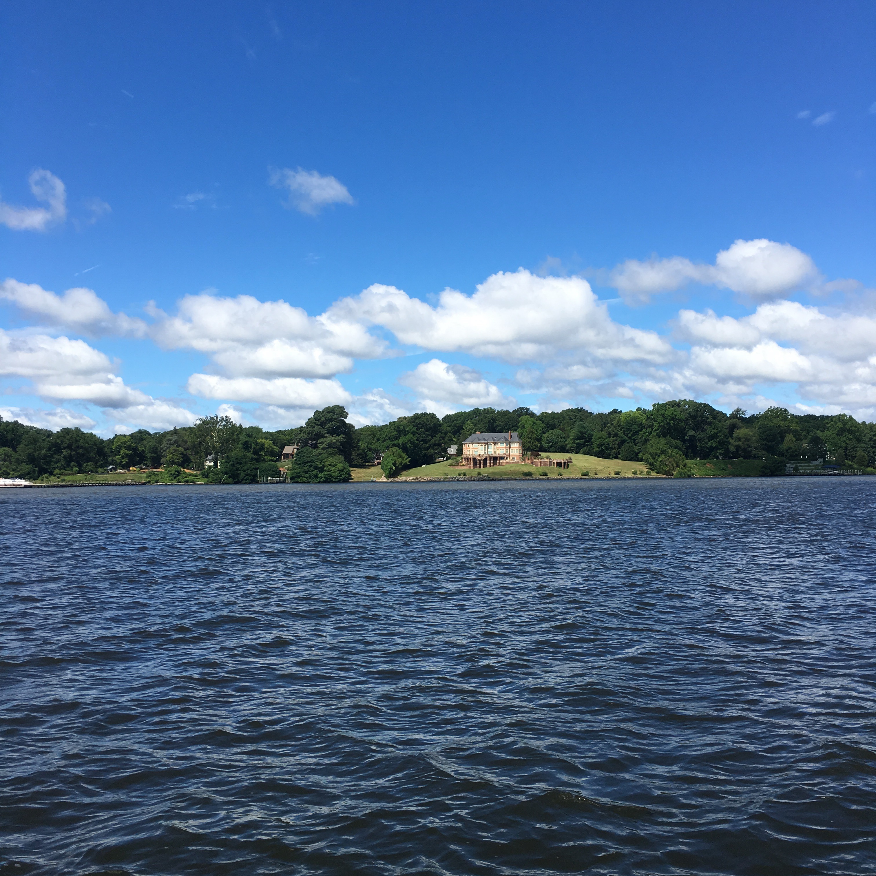
This was two days later on the Potomac. Same temperatures but with wind relief. Very nice. Even looks cooler doesn’t it?
Monthly Archives: July 2017
Crab Pot
The bane of intracoastal cruisers these seasonal traps are everywhere. They are at times waywardly placed in the middle of navigable routes, which is where we connected with one or should I say connected to us. It was broad daylight (and you can imagine the extra challenge at nighttime) and was unseen but suspect when we heard and sensed a thump. A crap pot consists of sunken coup resting on the seabed, a stout retrieval line is floated to the surface by a marker buoy. Boaters must scan for these little floats but they are easily obscured by wavelets and glare. The float marker, styrofoam and plastic, can be harmlessly nudged aside by the hull but it’s the attached rope that is drawn to your spinning propeller that is the spoiler.
After the unexpected bump scan checked engine RPM and detected no changes in sounds or frequency but did note a loss in speed of about 1 knot. Aside from the thump this was the only clue. The only way to know for certain was to inspect the prop.
The prop is about 2′ below the surface and the only way to view is to stop and go over the side with mask and flippers; an unscheduled swim.
Most of these pesky hazards are in coves and harbors, anchorages are littered although in fairness they are distributed in linear string fashion every x number of feet. When you are anchoring they can be intimidating and always a challenge to stay clear to avoid mixing. If you happen to tangle, your prop is likely to be jammed into a non-functioning balled up mess. A saw tooth hand knife is necessary to laboriously cut the cord away. An enterprising idea is to install a set of propshaft blades that act to preemptively slice and dice. 
I’m not convinced that this would actually work effectively at slow maneuvering RPMs in an anchorage or when using reverse.
During my impromptu inspection I discovered we had indeed been fouled and had been dragging an entire bundle of float, line, and trap for a mile. Our prop-wash had slammed the float through the propeller aperture snagging on the rudder without the line wrapping up in the prop. Phew! Lucky easy removal for us — but not for the Waterman. He will be wondering where his Crab Pot and Catch are…
Local Knowledge
There was an obscure note on the chart that we overlooked. It needs bells and whistles because it caused some chagrin. Transiting local shoreline routes are challenging due to shallower water and obstructions. Our Washington DC back to NC trip just completed was roughly 450 miles of mostly Atlantic Intracoastal Waterway (ICW) so I guess we were fortunate that we escaped [most of] the unseen. The ICW is supposed to be maintained to a nominal depth of at least 12′ at low tide. Talmid requires 6′. 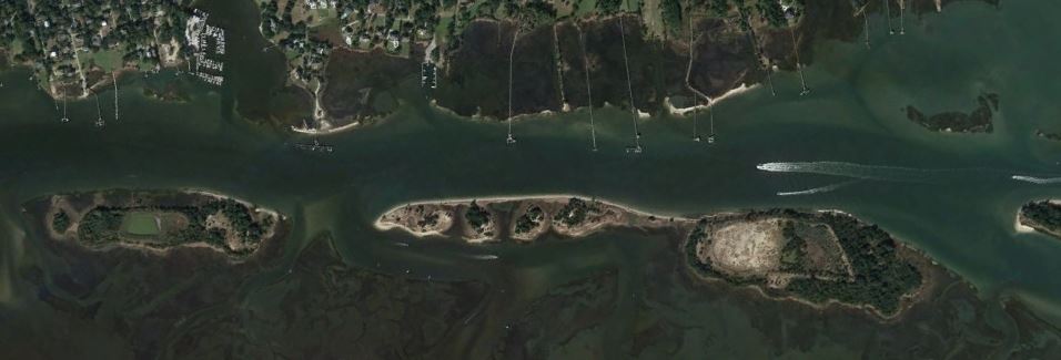 Satellite view of the Masonboro Sound on the New River – Cape Fear River
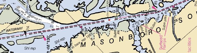 …and the NOAA chart presentation – same locale
The dashed lines indicate the charted bounds of the ICW. Here is a closeup of the chart and observe the notice that we found pertinent which reads Shl to 5 ft 2016.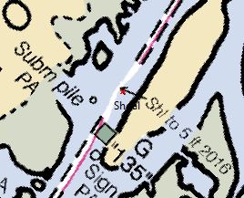
Translated: Shoal to 5 feet and dated last year. Ordinarily this would not be a problem area at high tide and I’d been through here twice before but at low water our deep keel found it — and we slid to an abrupt halt.
Worth mentioning is that the inland water is murky dark. Your eye can’t tell if it’s 2′ or 20′. There is a depth transducer onboard which gives us a digital indication of actual depth. We have a aural warning alert set to 10′ to get our attention should depth become a concern. In this instance it did give alert but the depth readout quickly went to 8′ and then just as fast I saw 4.6′ with no time to react. Stuck.
Pure sand bottom, so damage only to my ego. We were able to use reverse propeller at max RPM to extricate and not have to wait for the water to rise. After the fact, and back at my desk, I downloaded this Hydrographic Survey from the Army Corp of Engineers and one can clearly see the issue. The image below is the satellite view with the survey overlay.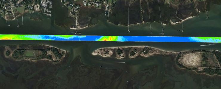
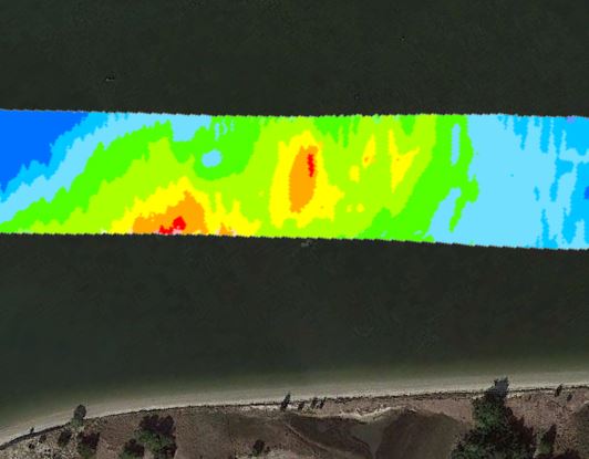 …and the relevant closeup section (just North of green lateral daymark #135)
Blue is 15+ deep water. Red = bad; and must be avoided. Ordinarily you keep the boat between the channel markers and you should be okay. From the comfort of my armchair I can see that the preferred and ONLY route through favors the one side.
A published guide book might prove useful as no doubt there have been many gone before that made the goof. I can now say that I have first hand [local] knowledge.