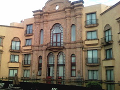
Stuck at an airport perimeter road hotel and not seeing anything exciting on the satellite map or encouraging from the Google Street View, I stepped outside anyway. The loop that I ran, thankfully, offered protection from the traffic with consistent asphalt sidewalk and granite curbstone. I did spy an isolated abandoned railway bed at an apex on Goffs Fall Rd. in which an adjacent foot path appeared to trail in the direction of downtown Manchester. Next time.
Category Archives: places
Thin Air
Crossing the Roaring Fork River before sunrise on the Stein Trail is a beautiful thing. This section joins the Rio Grande Trail, named from the railroad that used to follow the river. Despite the mountainous surroundings the trail grade never exceeds 3%. Looping back through residential completes the circuit on the Pitkin County Open Spaces and Trail system. My route began across the hiway from the Aspen airport on ABC road in the Business Park. Even in August the early morning air has a chill and a pair of gloves
would have been useful. The trail surface is hard packed crushed rock and sand. The multi-purpose greenway is concrete. 5.5 miles.
Irvine
The irvine Co. Salt Works circa 1934 to 1950 in the backwater head of Newport Bay, is now the Upper Newport Bay Estuary and habitat. Many trail signs to point out the ongoing rehabilitaion but nothing that some rain won’t cure. The trail traverses high ground (dusty dry) or low path (marshy bog).
sna2
A taste of Rhode Island
In Wichita – an unexpected sight. Bill Koch (local boy) built her for Cup trials in ’92. Jayhawk, was a throw away. I had a chance to see the super secret keel while leaving the downtown on a river run. Unlike a previous jog in the opposite direction, there is nothing else to see here folks. The view, as the river streams to Arkansas, becomes rural like and my 5 mile route was generally flat on asphalt greenbelt.
Average speed: nan min/mi
BOI
Had some daylight left to sample a portion of the Boise River Greenbelt. Avoid the unofficial Garden City trash trailer side of the river in favor of a picturesque Rocky Mountain Boise route. Paved surface. Elevation 2800 ft.
Average speed: nan min/mi
INDY
Finally got out. Even with the patchy snow and freeze over felt great. Fleece and Gore-Tex are necessary for the upwind bits. Leaving the Conrad in the downtown I picked up the White River Wapahani Trail and ran north. Concrete greenway with some soft trail on river’s edge.
Average speed: nan min/mi
Santa Fe
The safe way to navigate the Dale Ball Trail system is with a GPS handheld but fortunately it is well marked with a sign map at each junction obviating the need. The trail is best suited for biking with numerous switch backs and steep spurts through pinyon woods but was adequate for a jog. Luxury homes pepper the hillsides over looking Santa Fe. The outside loop is about 5 miles +/- with cut off trails to vary distances. Trail head parking is located at the junction of Hyde Park Rd and Sierra del Norte Rd.
Average speed: 9.35 min/mi
COS – front range trail
The Pikes Peak Greenway at the northern end of Colorado Springs continues as the New Santa Fe Regional Trail. The trailhead at Woodmen Rd. leads through an USAF Academy easement as it shadows Monument Creek. The section that I ran is broad dirt road with no obstacles other than the occasional mtn bike.
Average speed: nan min/mi
Springfield, MA
The Connecticut River Walk and Bikeway Trail is a good fresh air run. Inner city boom boxes drum from near distance. Best to stay with with a group. Level hard surface with few users on this late end of summer Sunday.
Average speed: 0.00 min/mi
Wichita
Ghostly Old Cowtown is a nice cool down stroll on the Arkansas River Bike Trail. My 4 mile loop, like the dusty town, had few users (weekday). The trail is asphalt / concrete and flat running.
Average speed: nan min/mi